The Fremont Trail System is a trail project that will enhance our community. Originally started in 2016 in response to the BLM’s and COPMOBA’s call for new trail projects in the Bangs Canyon SRMA, this project has evolved and grown to fill in the gaps of riding opportunities in the Grand Valley, address capacity challenges, and expand on the existing trails at the Lunch Loops and third Flats.
All the trail lines proposed for the Fremont Trail System are draft lines requiring lots of work to finalize them and present them in the final proposal. Please do not ride them! Doing so will put the project in jeopardy.
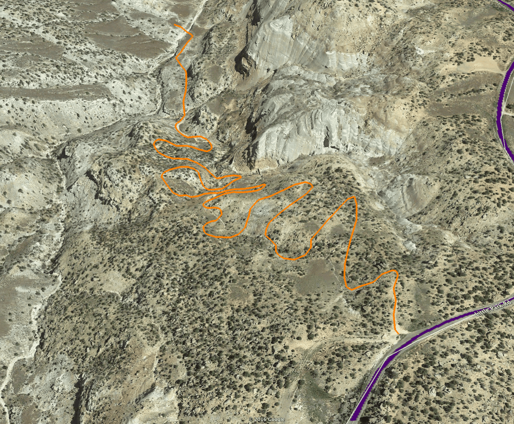
Fremont Trail System Proposal
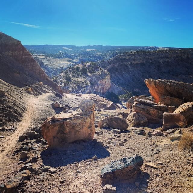
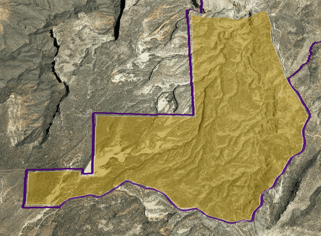
The Fremont Trail System (FTS) is a proposal for a new singletrack trail system within close proximity of Grand Junction, Colorado and directly linked to the Lunch Loops Trail System. This new system will provide intermediate to advanced trail experiences within the upper No Thoroughfare basin found between Little Park Road and the Eastern boundary of the Colorado National Monument.
The Trails
Designed with a rim, spoke and hub layout, the FTS will feature modern trail design for modern mountain bikes and trail users. Comprised of a mix of directional and bi-directional trails. Construction will feature sustainable trail design with large radius turns, constructed berm and jump features that integrate into the terrain, and an “all-mountain” trail experience.
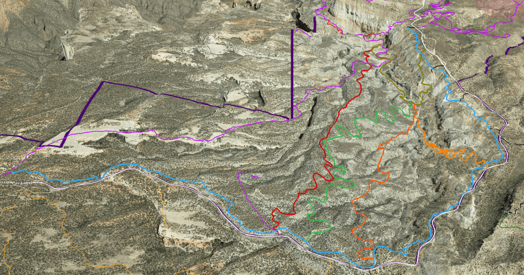
Orbit Trail Complex
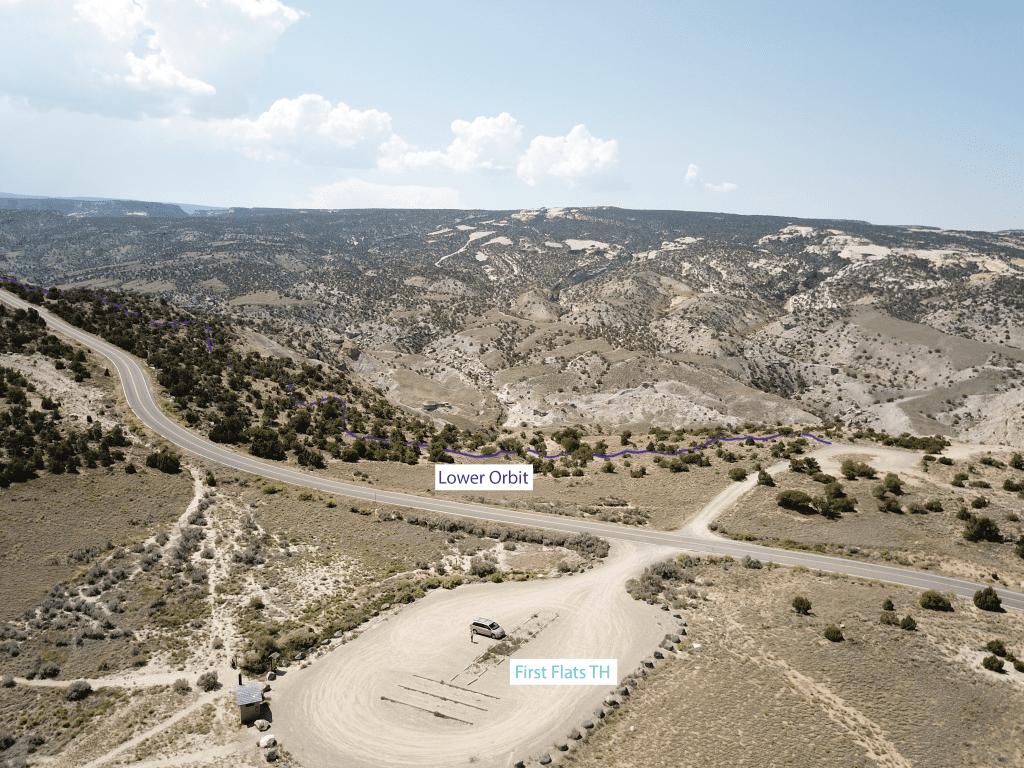
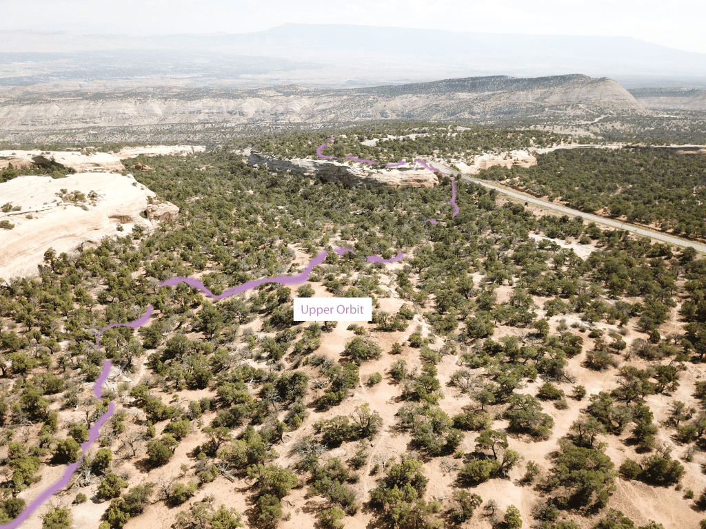
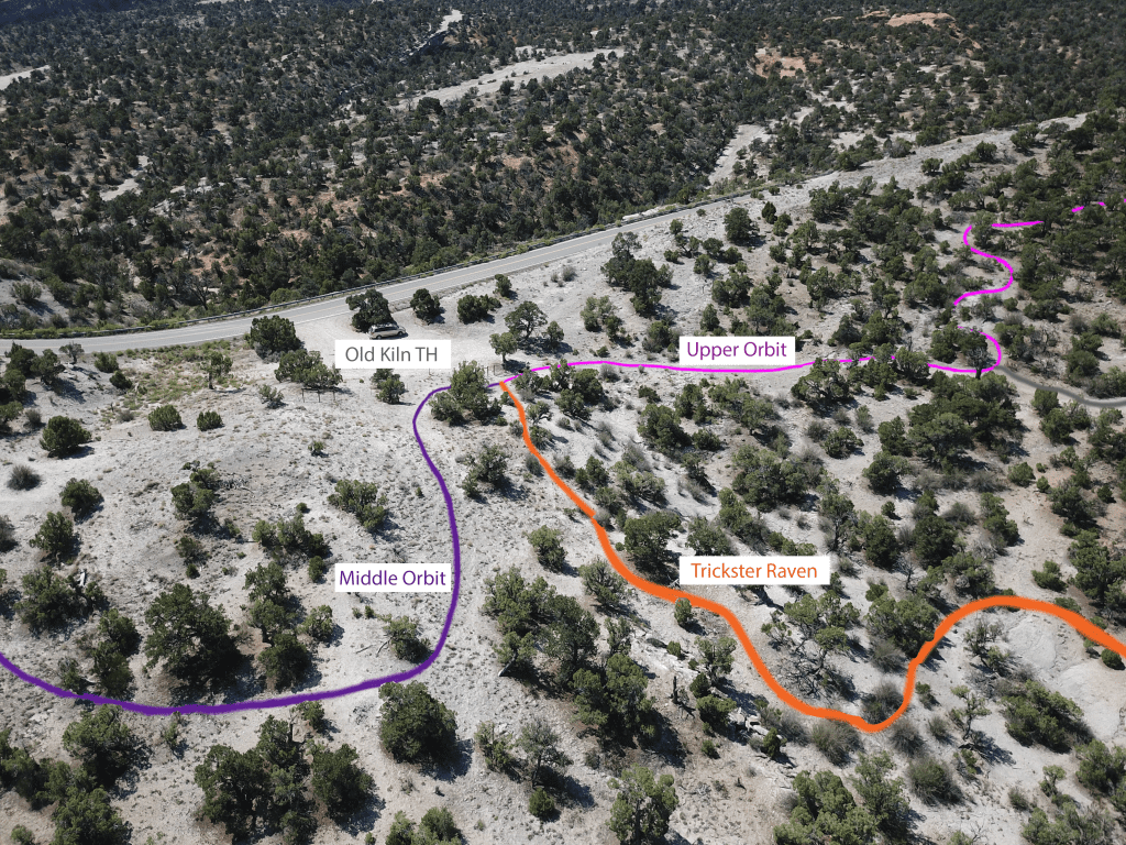
The Orbit Trail Complex is made up of three trails that parallel Little Park Road and connect the four existing trailheads over the four mile total length. The Orbit trails are bi-directional with grades designed to allow for climbing.
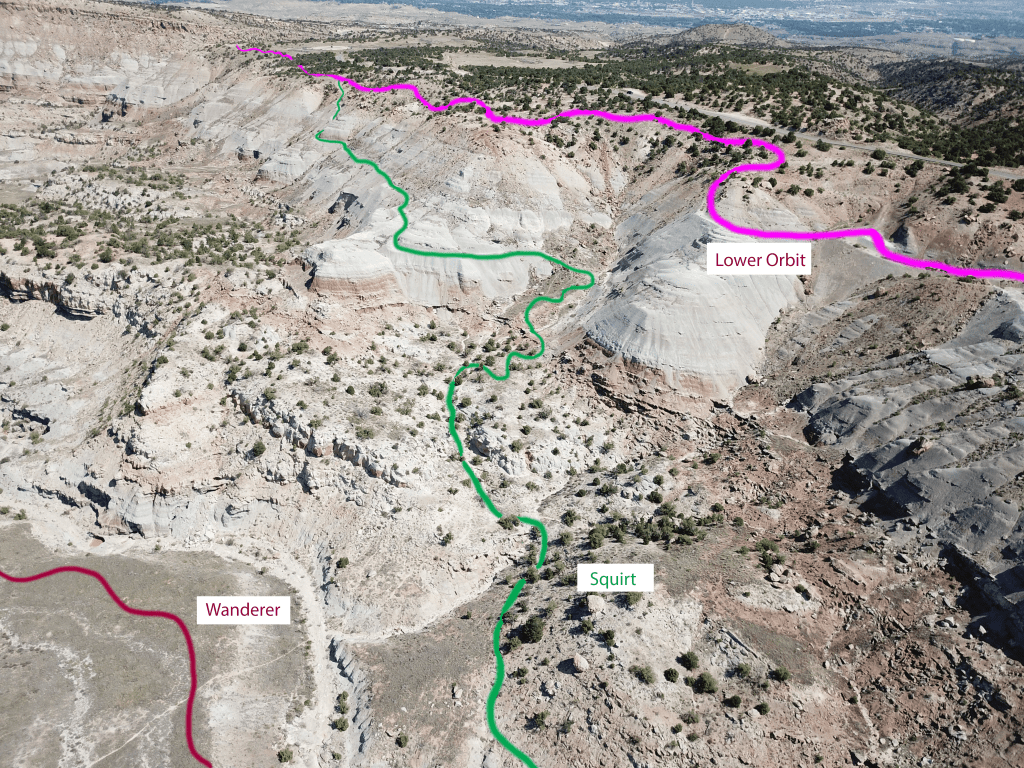
Lower Orbit Trail
At just under one mile in length, Lower Orbit will have approximately 250 feet of climbing through intermediate terrain. Designed to be fun in either direction, it will provide a key linkage for the system connecting riders to Squirt and Middle Orbit.
Middle Orbit Trail
At about one and a half miles in length, Middle Orbit has more vertical relief with approximately 400 feet of elevation and a few sections that push the character of the trail to Advanced Intermediate in nature. Designed to be bi-directional, Middle Orbit will primarily be designed for climbing.
Upper Orbit Trail
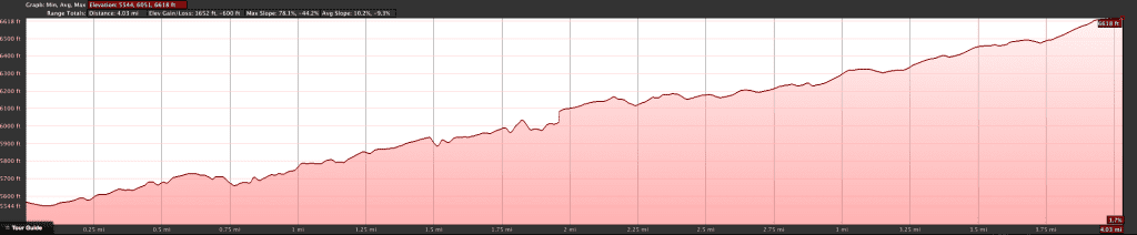
At nearly two miles in length, Upper Orbit has the most vertical and more sections that push into Advanced difficulty. It will be primarily ridden as a climbing trail, but has some fun descending sections.
Trickster Raven Trail
This directional downhill trail connects Upper Orbit to Wanderer and the bottom of The Ribbon (existing trail) via two and a quarter miles of 10% grade Advanced trail. This trail features built and natural jump features and will be a defining trail for the system.
Moki Rising Trail
Designed as a climbing trail to get riders up to Trickster Raven via Upper Orbit from the Nexus point in the core of the trail system, Moki Rising switch backs up through a variety of desert meadows maintaining a comfortable climbing grade over its three and a half mile length.
Remember this is a proposed trail project. All lines need to remain on maps and NOT on the ground. Trail projects are delicate and can be destroyed by unauthorized trail building.
Bullsnake Trail
Bullsnake is an Intermediate to Advanced downhill directional flow trail with berms, and jump features over its mile and a half length. Starting at about the halfway point of Upper Orbit, it descends to the Nexus point in the core of the system.
Cheveyo Trail
The “Goblin” is over a mile and a quarter of Expert directional downhill trail with large jump features over amazing terrain that includes boulders, rocks slabs, a natural halfpipe and steep descents. It connects from the top of Middle Orbit to the Nexus point in the core of the system
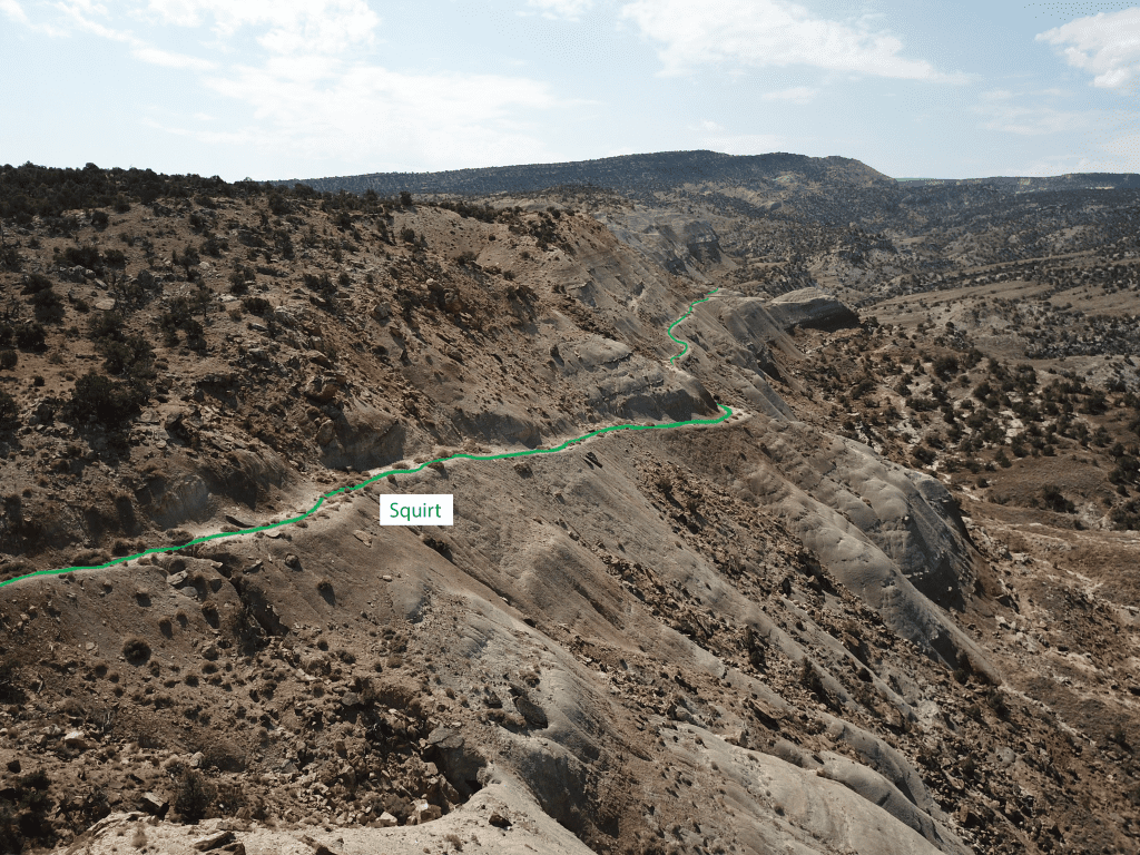
Squirt Trail
Climbing directly out of the Nexus to the top of Lower Orbit, Squirt provides an essential gateway out of and into the Fremont Trail System. Designed for climbing over its three quarters of a mile of singletrack, it will offer fun descents into the system for creative loops. Accessible as an Intermediate trail, it will be a break from more advanced trails it links to.
Gastrolith Trail
Gastrolith plays in a hanging basin that has amazing natural jump, berm and drop features and will be a favorite of riders looking for an Advanced park experience in a natural trail system. Directional downhill and about three quarters of a mile in length, Gastrolith connects the from the middle of Squirt down to The Ribbon allowing for connection back to Wanderer or an exit via Andy’s Loop (existing trail).
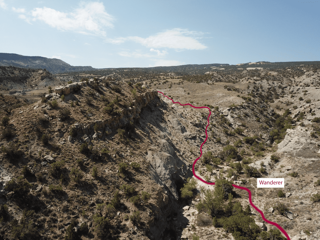
Wanderer Trail
As a true, bi-directional trail, it has unique experiences for climbing and descending riders. About a mile in length, at the bottom, the Wanderer provides an alternate option for The Ribbon (existing trail) around the Hospital Drop section and connects up to the Nexus. Designed to be comfortable as an climb with important connectivity from the bottom of the FTS and existing trails (The Ribbon and Andy’s Loop), the trail has some features that will be memorable as a descent
The Nexus
The Nexus is the hub of the Fremont Trail System and provides a linkage point for most of the trails in the system. Located on the eastern edge of the basin, it provides a point where descending trails connect to climbing trails.
Fremont Trail System Statistics
| Area | Approx 1,300 acres in SRMA RMZ-1 |
| Total Trail Miles | 13-3/4 miles of proposed new trails |
| Existing Infrastructure | 5 existing TH with 4 existing Vault Toilets |
| Connections | Lunch Loops, 3rd Flats Trails, The Ribbon, Andy’s Loop |
| Trail Character | Intermediate to Advanced Singletrack |
Why “Fremont”?
This project hopes to recognize the indigenous people who explored, lived in, and were driven off of the landscapes of the Grand Valley and region. The Fremont name is proposed as part of that effort in recognition of the amazing, mysterious peoples that lived nearby, hunted and grew corn, made distinct petroglyphs, and wore sandals between 12,000 and 700 years ago.
Please remember that all these trails are PROPOSED and are not to be ridden. Doing so will jeopardize the project.
Get Involved
We welcome your support, efforts, contributions, and ideas. Join Us